Category: Conference

  • 2nd place, Ph.D. Award 2016 of Telecom ParisTech

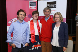
    The 2016 PhD graduation ceremony of Telecom ParisTech was held on the 21 April 2017. It was a great pleasure to graduate with some of my PhD friends: Sonia, so many nice memories. All my PhD supervisors also came to this event which was immortalised by a nice photo.


    The graduation started with the Telecom ParisTech Ph.D. Award ceremony. This award recognises the scientific quality, the innovation and social impact potential of the research performed during the PhD at Telecom ParisTech.
    I was a finalist and had to give a 5′ pitch. It was a difficult exercice but very interesting to summarise my PhD work and make it audible to the large audience.
    The pitch has been recorded and his available on youtube.

  • Presentation of my PhD work in video

    In the fall 2017, I was invited to give a presentation at the Research Day of the LTCI lab at Telecom ParisTech. It was a great occasion to meet my ex-colleagues and discover the hot topic of the other researchers. I would like to thank Etienne Borde that invited me and dealt with all the administrative work.

    As a speaker, I was interviewed on the work I presented, which mainly focused on the Eiffel Tower deformation. The interview was filmed and the result in now available on youtube. The interview is in French and subtitles are only in French for now but should be translated in English soon.

    Thanks to Henri Maitre, who interviewed me, Michel Desnoues, who filmed the interview and edited it, and Alexia Kappelmann, who organised everything, edited part of the video and inserted the slides. It was a real pleasure to work with you!

  • CryoSat 2017: first CryoSat conference and first CPOM blog post

    The first North American CryoSat Science Meeting was held in Banff, in the beautiful Canadian Rockies.

    As it was my first conference linked to my post-doc (which in on the swath processing of CryoSat-2 SARIn products), I learn a lot about the satellite, the processing done to create the L1b product, the retracker and all the applications achieved thanks to the satellite acquisitions. It was also the occasion to hike and snowshoe with researchers from all over the world.

    More information on the scientific question raised during the meeting and on follow-on mission can be found in my first CPOM blog article.

    http://cpom.org.uk/first-north-american-cryosat-science-meeting-news-follow-mission/

  • ODAS, sunrise at the DLR Oberpfaffenhofen

    The ONERA-DLR Aerospace Symposium 2016 (ODAS) was hold in the DLR facilities in Oberpfaffenhofen.

    It was the occasion of great exchanges between the ONERA and DLR remote sensing team. I learned a lot on the TerraSAR-X and TanDEM-X data acquisition and processing. I discussed with many DLR researchers and ONERA colleagues from different centers. Among them, I want to thank Thomas Kraus for his explanations on the Dual-Receive Antenna mode constraints and Andreas Schmitt for the discussion on how to handle data from different sensors in Pol-Sharpening algorithms.

    The DLR had also organized a visit of its facility. I really enjoyed discovering the different research aircrafts and the radar anechoic chamber. All the guides were so enthusiastic!

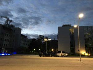
    The launch of one of the Firebird satellite occurred during ODAS. We had the opportunity to follow it in The German Space Operations Center with the teams that worked on the satellite. Even if all the presentations were in German, it was a great experience. The launch was in India at 05:55 CEST. It was thus the occasion to see the DLR center nearly by night.

    IMG_1235

  • EUSAR 2016 Student Award: first place

    My article entitled “Resolution enhancement of polarimetric images using a high resolution mono-channel image” won the first prize of the EuSAR 2016 Student Award. The work presented in this article was the extension of the work I presented in POLinSAR 2015.

    This article deals with the main goal of my PhD which is the merge of high resolution single-pol image and quad-pol images acquired with the same sensor in interferometric condition in order to produce high resolution quad-pol image. The polarimetric features of the scatterers have to be preserved as well as the interferometric capacity of the initial quad-pol image. Our goal is thus to preserve the power of the polarimetric channel but also its phase. A spectral approach based on the spectral properties of white and isotropic point-like scatterers has been chosen. The pixels of the images are thus modeled as the sum of the point-spread fonction of point-like scatterers, which can be approximated as a cardinal sine in both direction, and a fully developed speckle, dominating in homogeneous areas.

    In this article, two spectral algorithms are presented. The first one, called the sum method reconstruct better the point-like scatters but correlated the polarimetric channel in homogeneous areas. On the other hand, the algorithm called the center-point method preserves better the speckle properties. These two algorithms are merged, based on a point-like scatterers and bright lines detection.

    The results are illustrated on images acquired over Salon de Provence by ONERA’s SETHI sensor and images acquired over Amsterdam by TerraSAR-X. In order to process these real data, preprocessing such as the spectrum unwrapping and unweighting are also needed. These preprocessings are implemented in order to deal with data acquired by different sensors with various resolution ratios.

    The final processing chain is a versatile tool to create high resolution polarimetric images from polarimetric images and a high resolution mono-channel images.
  • DInSAR on the Eiffel Tower for the Gretsi 2015 in Lyon

    SAR Interferometry (InSAR) and SAR Differential Interferometry (DInSAR) are two well-known techniques of Synthetic Aperture Radar (SAR) image processing. SAR Interferometry measures the phase difference between 2 images acquired from slightly different points of view to obtain the height of the scatterers. Interferometry is often multi-pass: the two images are acquired by the same sensor at different time. But it can be mono-pass if the two images are acquired at the same time,  such as TerraSAR-X and TanDEM-X conjoint acquisitions. SAR Differential Interferometry is always multi-pass: this technique permits to retrieve the movement of the scatterers between the date of acquisition from the phase difference between 2 images acquired from the same point of view.

    In this article, we show that the height retrieval from multi-pass acquisition over target which shape changes can give tricky results. We carry out this study on a temporal serie of 10 SAR images acquired by TerraSAR-X in 2009 and we focus on the measure of the height of the Eiffel Tower since it is normally a target with a well-known height!

    After unwrapping the phase on the Eiffel Tower, we compute its height throught interferometry. The measured height could exceed 1km! We credit this error to the mixture of the interferometric phase with the phase due to the displacement of the scatterers in time: DInSAR is needed.

    To supress the interferometric component, we used the official height of the Eiffel Tower as a DEM.  We found dilatation up to 4cm. Depending on the baseline, this deformation could lead to the kilometric error on the interferometric height. If a deformation model was available, it would be possible to compute the deformation conjointly with the height. Studies on the deformation of buildings make often the assumption that the variation of height is linear and estimate only a deformation velocity. This is not possible for the Eiffel Tower because its deformation depends heavily on the weather (temperature, wind and the amount of sunshine per day). It is not regular in time. Complementary information on the deformation of structure and the weather at the time of acquisition are thus needed to validate to estimate conjointly the height of the first acquisition and the deformation.


  • In a week of Multitemp 2015, in Annecy

    My presentation will focus on the comparison between spatially estimated polarimetric entropy and temporally estimated polarimetric entropy. Indeed, long term temporal series become accessible for SAR images in full-polarimetric mode, thanks to the new lauches of satellites and to the wider distribution of SAR images by spatial agencies. It allows to monitor the evolution of scattering mechanism in time and to use different tools to characterize the scene.

    Polarimetric entropy is a classical tool for PolSAR images study and classification. It is often used as an indicator of the variability of scattering mechanisms for given homogeneous areas. In order to estimate entropy, the covariance matrix has to be estimated. This is mostly done using the sample covariance matrix estimator on adjacent pixels. Thus, the entropy becomes an indicator of the variability of scattering mechanisms present in the sample set used for its estimation.

    Using a temporal series, new estimation methods of entropy can be employed. For example, entropy can be estimated using the temporal samples of the same pixel. This temporal entropy gives us information about the temporal stability of the scattering mechanisms. New classes of scatterers seem to emerge in natural areas. In urban areas, the contrast of entropy between streets, parks and buidlings is less dependent on the street orientation with temporal entropy than with the classical spatial entropy.

    These results on entropy estimation open new perspectives for an Entropy/alpha classification scheme combining spatial and temporal entropy.

  • Paper accepted as an oral presentation at POLinSAR 2015

    The paper deals with the enhancement of the resolution of polarimetric SAR imagery.

    Due to technical constraints on the system design, the azimuth resolution is coarser in polarimetric images than in the mono-channel acquisition of the same SAR sensor. We aim at enhancing the resolution of polarimetric images using a high resolution image. The idea is close to the concept of pansharpening in optic image processing. But unlike optic pansharpening which is used to improve the visual quality of images, we want to preserve the polarimetric behavior of the scatterers in the image so that the resulting image remains useable for classification purpose.

    The speckle phenomenon makes the concept of resolution unclear in homogeneous areas. For bright points or point-like scatterers, improving the resolution means decreasing the width of the main lobe of the PSF. This can be achieved by expanding the spectrum of the original image. The location of the SAR spectrum in the Fourier space is directly linked to acquisition parameters: the angular aperture and the bandwidth. Based on the hypothesis of isotropic and white targets we can use the polarimetric behavior of the low resolution image to expand the spectrum while keeping the initial polarimetric behavior.

    Post conference note:
    My presentation entitled Spectral method for bright scatterers resolution enhancement can be accessed on the POLinSAR 2015 website.